
Stirling Falls travels 155 m (500 feet) into the water. Bowen Falls at the base of Mitre Peak is 163 m high.


The top of Mount Pembroke with its snowy Pembroke glacier was fully visible. This is the case only 25% of the time.
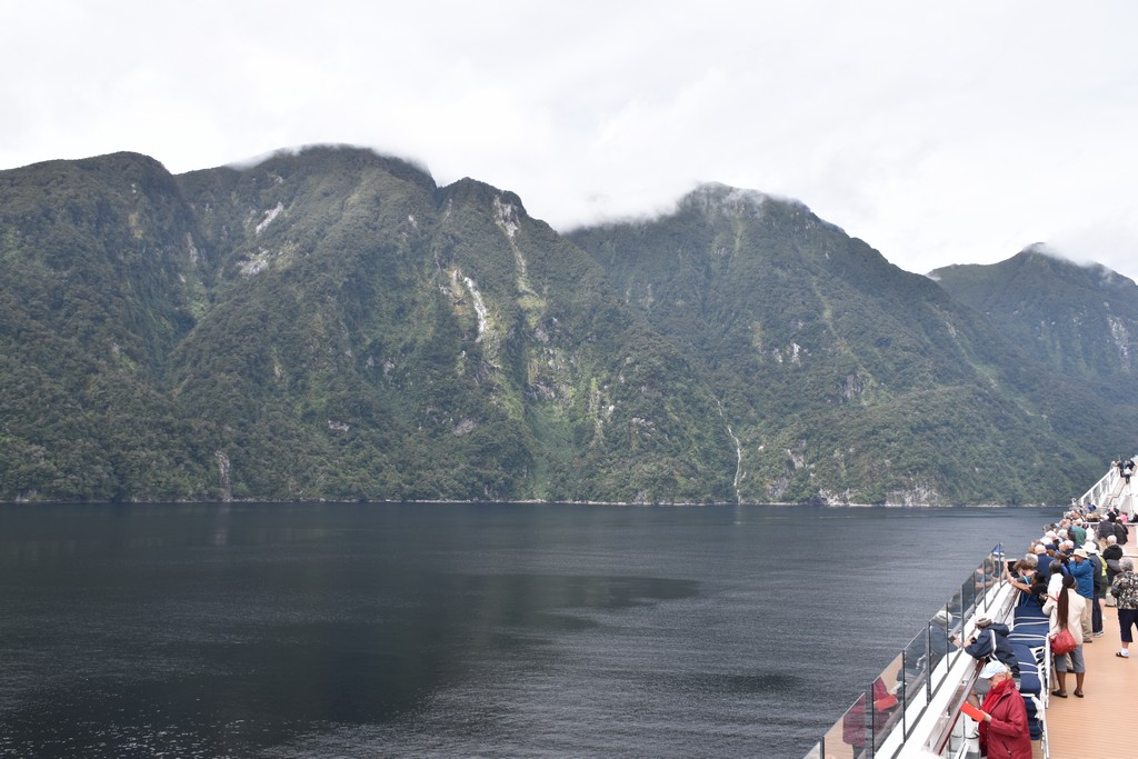
The hillsides are forested with beech trees which are resistant to the variable weather conditions in the area. These trees have a shared lineage with the forests of Patagonia and Chile, reinforcing the geological history of the area showing that New Zealand broke away from the coast of South America. Visible scarring on the granite hillsides is due to landslides and glacial action.

Leaving Milford Sound, we travelled along the mainland to the entrance of Thompson Sound, leading into Doubtful Sound. Captain Cook named this sound because he was reluctant to travel into it, unsure that he would ever find his way out.
On average, rain falls more than two hundred days each year. Therefore there is a permanent freshwater layer sitting on top of the salt water in the fiord. The beech tree leaves leach tannins into the water giving it a very dark, almost black, colour. Very little light penetrates into the sea water layer. This creates a "deep water" sea habitat within diving depth allowing scientists to study these unique organisms.
By mid afternoon we entered Dusky Sound, so named by Captain Cook because of its somber, wet, cloudy conditions. But not today, as the sun broke through the clouds. This is the largest of the sounds with many islands. It is also very remote, only accessible by boat or on foot. One of the largest islands is Resolution Island.
The forests of New Zealand were originally inhabited by insects, reptiles and birds - no mammals except fur seals and bats. The birds thrived and became very large. Many of them lost the ability to fly and wandered the forest floor with no predators. The now extinct Moa reached a weight of 440 kg (900 lb). Eventually, New Zealand was settled by Polynesians, 600 - 800 years ago. They cultivated crops and hunted birds for food. Then Europeans brought grazing livestock, new plants and some mammals like stoats and rats which were very destructive to the defenseless birds. Now Resolution Island has been set aside as a wildlife refuge to re-establish the very unique native species and prevent further extinction.
We get excited when we are kayaking and see half a dozen dolphins. We were thrilled to be joined by about 60 bottle nosed dolphins along the side of the ship who put on quite a show.

