Sunday, February 18, 2018

Two days in Auckland, NZ

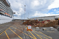
We have left the Celebrity Soltice for the last time. Now we have two days to explore Auckland, the largest city in New Zealand with a population of 1.6 million people. At one time, Auckland was the capital of New Zealand.  However, the capital was moved to Wellington in 1865 in order to be more central to the country. Departing the ship took no time at all so we had all day to explore.


The commitment to bilingualism is very apparent here in the city.  Children are educated in school in partial or full immersion Maori/English.  Signs are bilingual.  The national anthem is sung first in Maori and second in English at events.  When the English arrived, they encountered fierce warriors and decided to sign  a treaty rather than try to conquer them. Anyone who has seen the Haka (Maori war cry) would understand why.
The treaty of Waitangi was signed on Feb. 6 1840 by representative of the British crown and Maori chiefs of North Island. Over the years, however, the Maori suffered loss of culture and land.  A reconciliation process began in 1975 and settlements are still occurring.  It was interesting to see how the Maori are integrated into the population of New Zealand, with 15% of New Zealanders claiming to have Maori blood.  At the Auckland War Memorial Museum we saw a presentation about Maori history and culture.

The museum sits on the grounds of a 75 hectare park - The Domain - sitting in the crater of the Pukekawa volcano. with the cricket pavillion, The Wintergarden, sports fields, duck ponds, and hundreds of different trees.

From high atop the rim of the old volcano we descended to the harbour which opens to the Pacific Ocean. Auckland is known as the City of Sails.  The Westhaven Marina, under the Harbour Bridge, holds 2000 boats.  The original bridge was built in 1959.  By 1969 more lanes were needed to accommodate the traffic.  A Japanese company engineered extensions to each side of the bridge - known affectionately as the "Nippon Clipons".


After crossing the bridge to the North shore we drove to the west coast which sits on the Tasman Sea.  New Zealand is very narrow at this point. The beaches along the west are totally different.  We drove through rugged hills as we crossed to the west coast.  First stop was the Arataki Visitor Centre in the Waitakeri range.

Part of the Hillary trail runs through this area. The trail itself is 76 km (47 miles) long.  It was established in honour of New Zealand's famous citizen Sir Edmund Hillary who conquered Mount Everest.

We walked through part of the trail with our guides identifying native plants which have re-established themselves on these hills which were clear cut by the European settlers as pasture land. The guides also talked about the continual need to remove the non-indigenous mammals which have destroyed so many native birds.  Traps and poison are used to kill possums, stoats, rats, and weasels.  There is a program known as TIMBY - "trap in my back yard" supported by the government.

Then, on to Karekare beach near the town of Piha. Here the sand is a mixture of volcanic rock and iron oxide.  It is a popular spot for surfers as well due to the huge waves.

"Magnetic sand"


Friday, February 16, 2018

Bay of Islands

The Maori people consider Bay of Islands on the north east tip of the north island "the birthplace of New Zealand." This is where the Maori from other south pacific islands settled. The area is so named because it encompasses 144 islands between Cape Brett and the Purerea region.    

We woke up to another beautiful day and tendered in to a pier bordered by beautiful sand beaches.  There we boarded a bus to take us to "the forest".


We drove through very productive farm land producing citrus, kiwi, avocados , macadamia nuts, hay, corn and grassy fields for dairy and beef cattle, sheep and horses.  The climate is perfect for farming with temperatures in the winter of 9 - 10 C (48-50 F) and in the summer of 34-35 C (93-95 F) with plenty of rain making the countryside lush and green.  Suddenly we arrived at a subtropical rain forest - The Maningenangina Scenic Preserve . A boardwalk winds through a mature stand of kauri, swamp forests and giant ferns.

Kauri are among the world's largest trees, reaching heights of 50 m (165 feet)). The circumference reaches 16 metres (52 feet).  They are coniferous trees which live for 2000 years.  We stood in the presence of trees that were growing here before any human inhabited this land.


Our next stop was at the Kawiti Glow Worm Caves.  We were not able to take pictures in the caves as the worms stop glowing for a couple of hours when exposed to light.  The cave is limestone and sandstone with numerous stalactites and stalagmites.  The glow worms secrete a hollow tube attached to the roof of the cave.  They then secrete lines of sticky saliva hanging down from the tube which trap flying insects like mosquitoes, moths, midges, and mayflies.  The worm then sucks up its prey like eating a piece of spaghetti.

We did not take this picture - it was found on the internet.  It gives an idea of the beauty of the cave.

Tuesday, February 13, 2018

Valentine's Day in Napier NZ


Napier is a seaport located in Hawke's Bay on the eastern coast of the north island. The city was rebuilt in art deco style  after an earthquake in 1931.  The port is a major container terminal with a constant flow of logging trucks with pine logs destined for Japan.

We arrived on the first day of the Art Deco Festival. The streets were filled with antique cars and people in period costumes to greet us.


The rubble from the earthquake was used to extend the land out along the waterfront and covered with grass.  Today there is a sunken garden, mini-putt golf course, playground, skateboard park and beautiful parkland along the edge of the harbour. 


We walked to the National Aquarium of New Zealand along the walkway lined with Norfolk Pines. We saw "Little Penguins" who had been rescued and searched for the elusive Kiwi but still only found a stuffed one.


The down town area was ideal for some souvenir shopping (grandchildren take note). Tomorrow is a day at sea as we make our way to the northern tip of the north island.


Wellington

Wellington, at the southern tip of the north island, is the capital city of New Zealand separated from the south island by Cook Strait.  The population of the city is about 200 000.  Our ship was moored at a working port where some of the buildings still show damage from the earthquake of 2015.  Free shuttle busses took us to the downtown core. Our guide yesterday recommended visiting Te Papa Tongarewa (The Museum of New Zealand) within walking distance of the tourist information booth downtown.


Entrance to the museum is free but we opted for a guided tour to make the most of our time here.  Our guide Tina was of mixed heritage - half Maori and half "Pakeha" - New Zealander of European origin.  Our tour began at the Waharoa - a carved gateway to a traditional Maori village. It was carved from a slab of totara wood 6.6 m (21 feet) long and 1.2 m (4 feet) wide by Neke Kapua of the Arawa people and his sons for the International Exhibition in Christchurch in 1906-07. The wood was originally dyed with red ochre. The eyes are abalone. TIna told us the creation story of the Maori. In the beginning there was a great void between Earth Mother and Sky Father. They lay together and children were created between still in the dark until a great demi-god cut the ties between earth and sky and the light flowed in.
One area of the museum was devoted to a tribute to the New Zealand soldiers who fought at Gallipoli, a disastrous campaign of World War 1 where 5800 allied soldiers died.

Throughout the museum are displays about the natural environment, geological past, and the  social history of New Zealand.  Te Papa was built as a tribute to biculturalism in the country. We were thankful to Tina for her insight into Maori culture and knowledge of the ties to the peoples of the South Pacific.


Monday, February 12, 2018

Akaroa to the Southern Alps

Akaroa was settled by the captain of a French whaling ship in 1840.  The heritage was apparent from the street names (rue ...), shops (boulangerie) and even the police station (gendarmerie).  We drove out of town onto the Canterbury Plain on what our children called "spaghetti roads" in Switzerland.  The main exports of New Zealand are milk products (mainly to China), lamb, and lumber.  The vast stands of Monterey pine are not indigenous to New Zealand but are planted as a 25 year crop.  We also saw vineyards and olive groves. After a one and a half hour drive, we were half way across New Zealand's south island.


At Rolleston, just outside of Christchurch, we boarded the TransAlpine Express. We travelled along the ice fed Waimakariki River into the Southern Alps through miles of native beech forest.

 The first part of the journey was through farmland on the plains.  We saw sheep, dairy cattle and deer for venison in fields.  Also hay, potatoes, peas, wheat and corn.  Gradually the mountains came into view.


The scenery was more spectacular at every turn.  We travelled through tunnels, and viaducts over deep chasms.  Eventually Mount Cook was visible with its snowy glacier on top at a height of 3724 metres (12 000 feet).


We left the train at Arthur's Pass.  Our bus then took us to Homebush Farm where the Deans family oversee 1350 acres and 4000 sheep.  There we had "lunch" - a buffet of salmon, lamb, beef, vegetables, salads, bread and rolls, fruit, cake, wine, tea, coffee.  After lunch we watched a sheep being sheared and saw the resident dog Jim, a bearded collie, round up the sheep.


It would have been difficult to stay awake on the ride home except for the steep roads and sharp curves we negotiated on the way back to the ship.